Community Projects

%

Local

Volunteers

DIEM

A community-based mapping project

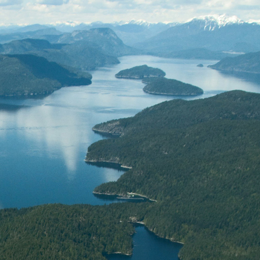
In the Discovery Islands, the meeting of land and sea is dramatic. Here are BC’s highest mountains, glaciers, and powerful rivers. Icy fjords meet Canada’s warmest ocean. The area claims some of the northern hemisphere’s most powerful outflow winds and tidal rapids – and within 25 km there are vast temperate rainforests with truly giant trees and desert islands that grow cactus. The extreme physical diversity and climatic influences create a large variety of habitats and high biodiversity – now identified as sensitive ecosystems and refuge for species at risk.

But the future is threatened by the past 130 years of human impacts. These changes are cause for concern – and the reason for the Discovery Islands Ecosystem Mapping Project (DIEM) which has a goal to provide better information for community and land use decisions.   

We recognize this place as the traditional territory of the Homalco, Klahoose, WeWaiKai, and Kwiakah peoples.

The Project

The Discovery Islands Ecosystem Mapping (DIEM) Project is a community response to top-down land management, concerns about development impacts, and questions about what’s appropriate.

Ecosystems

The islands have a rich diversity of habitats in a dynamic mosaic of ecosystems that includes shorelines, estuaries, creeks, wetlands, ponds and lakes, meadows, woodlands, forests, and cliffs.

Mapping

DIEM’s SEI and Enduring Features base-maps are the result of GIS digital information processing that identifies terrestrial and freshwater ecosystems and geological features.

Get Involved!

Citizen science is empowering local voices and involvement in planning decisions by identifying and validating community interests and concerns about development impacts.
A Special Thanks to Our Sponsors

DIEM | A community-based mapping project

In this magnificently beautiful place of remote wilderness, small communities, and industrial resource use, impacts and planning decisions are happening without complete information, and partial ecosystem data that exists is not presented in a way that non-professionals can understand. Stewarding this area’s unique and valuable natural resources requires identifying and quantifying what is here – and making the information accessible to everyone.