The Read Island Protected Landscape Network (PLN)
We respectfully acknowledge that we live on the unceded traditional territory of indigenous peoples, including the Homalco, Klahoose, WeWaiKai, WeWaiKum, Komoks, and Coast Salish First Nations. We endeavour to protect the land and its creatures for those who come after us.
The PLN Maps Tell a Story
This set of maps tells a story about Read Island’s network of forests, freshwaters, and other sensitive ecosystems. The maps illustrate where ecosystems naturally occur and interact, and where they have been impacted by human activities. In this area, the ecological integrity of island watersheds climaxed as old-growth forests. These complex ecosystems have the highest levels of biological diversity, produce the highest quality water, and sequester and store far more carbon than any other coastal ecosystems. The ancient trees and forests survived eons of natural disturbances – but have mostly succumbed to recent pressures of industrial logging.
The Protected Landscape Network (PLN) begins with learning about what-is and what-was, with a goal to protect and restore Read Island’s habitats, and the biodiversity supported by its integrated natural systems. Read Island’s character and current condition have directed the PLN design. Considerations included composition of the ecosystems, their species, structure and patterns, and their function/processes; enduring features, topography, soils, and ecological sensitivity. Guided by this information, the MAP 7 PLN identifies the ecological linkages that are critical to Read Island’s ecosystem functions, and where connectivity is broken or impacted. The Protected Landscape Network is a mapped plan for how to repair and protect the biological corridors that provide habitat and sustain island ecosystems.
The PLN methodology can be applied in any watershed, and we hope that presenting these ideas helps to inspire ecosystem based conservation planning in other communities.
Ecological Sensitivity
By their very nature, ecologically sensitive (ES) sites become part of a Protected Landscape Network.
Ecologically Sensitive sites are inherently less resilient, especially vulnerable to disturbance, and slow to recover from change.
Old Forests
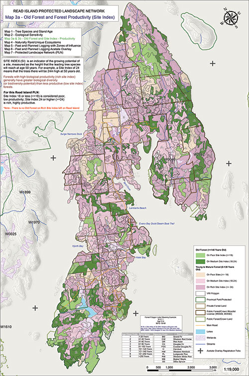
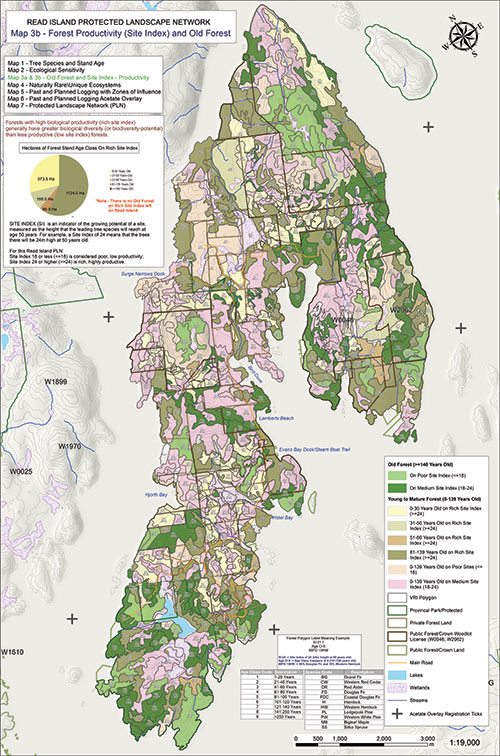
Old forests contain the highest levels of biological diversity. Old forests have the most ecological resilience. Well-established (old) forest systems are least likely to be affected by climate disruption, and Old Forests are important as refugia for species affected by changing conditions and the climate crisis.
Forests and Site Index/Productivity
Read Island’s natural character included rich biological diversity in forests of giant trees that thrived in a landscape linked and nourished by a stable network of freshwater ecosystems.
Rare & Unique Ecosystems
Naturally Rare Ecosystems are included in the Protected Landscape Network. These rare and unique areas have been determined by analyzing data sets for vegetation, enduring features, topography and ecological sensitivity.
Read Island’s Protected Landscape Network
Our Read Island Protected Landscape Network (PLN) has been designed using established principles of ecosystem-based conservation planning, which focuses first on what to protect, and then on what to use. What to protect is ecological integrity.


